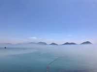
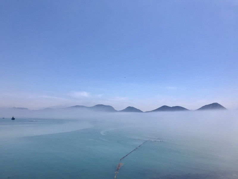
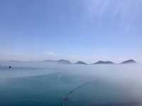
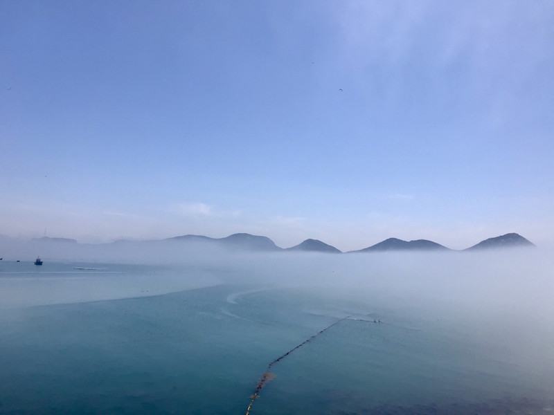
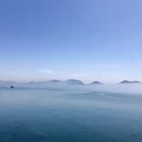
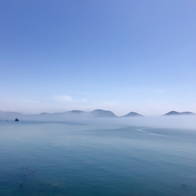
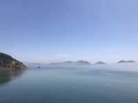
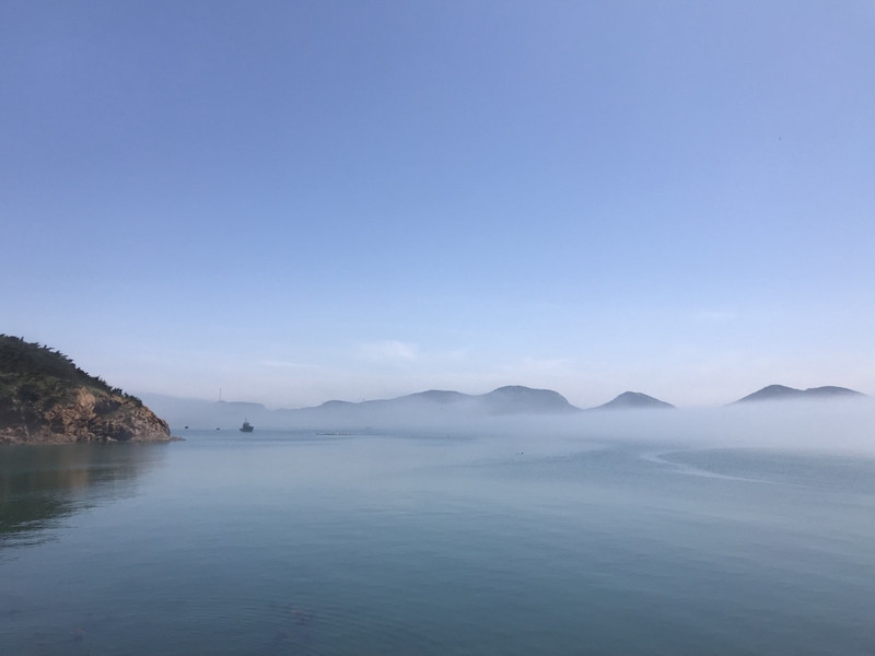
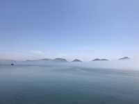
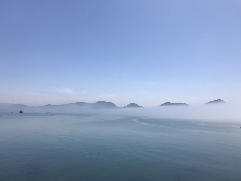
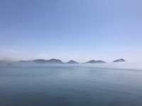
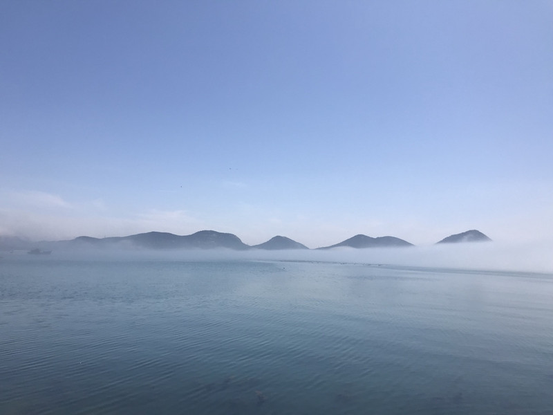
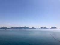
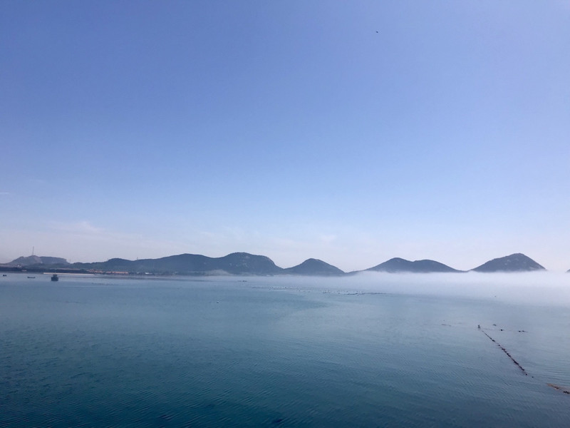
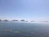
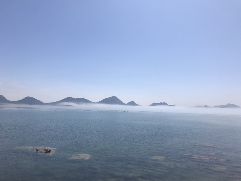
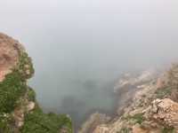
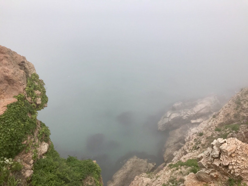
I don't say you really don't know where it is, except for Earth, the sky is beautiful, the sky is full of clouds and mists, how lucky we are to meet the Skyscraper to see the sky through the clouds and mists
Motianling Review
4 /5203 Reviews

1 / 11


5/5
Motianling
Posted: Jun 23, 2018


17 person liked this
Like
 5/5OutstandingOriginal Text
Lianshanguan skyline is a natural barrier on this ancient road. The mountains are steep and majestic. The shrub forest composed of red pine, larch, scorpion, scorpion, scorpion, scorpion, scorpion, scorpion, scorpion, scorpion, scorpion and other trees, with lush branches and greenery. The king of the imperial history of the east of Mingliao, the governor of the imperial history of the imperial history, depicted it with five-word poems, "even the mountains are green and the horses are also able to pass. Related to the condensing of the Han, through the forest and cover the sky", which can be seen as the mountain's top and the geographical weight.
Posted: Aug 31, 20231 5/5OutstandingOriginal Text
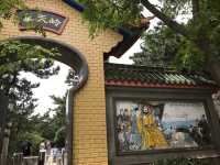
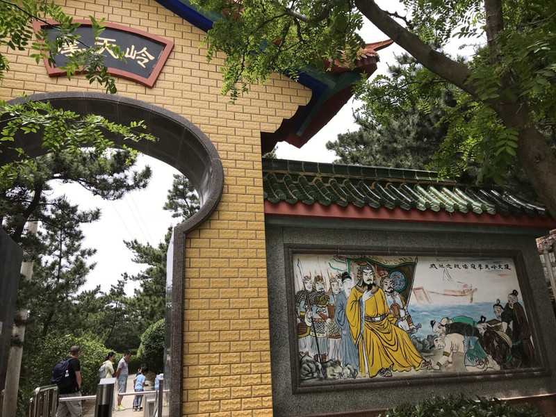
Motianling is located in the east of Liaoning, 80 kilometers west of Benxi City south, 50 kilometers from Liaoyang City northwest, is the east-west boundary of Benxi and Liaoyang Mountain, and the north-south is the boundary point of Lianshanguan and Xiamatang and town. The mountain is 969 meters high. Because of the mountain height, it is called the skyline, also called the Dagaoling, Taikaoling or kaoling. In war years, it is a military key place, and in peacetime it has a high tourism development value.
Posted: Aug 31, 20230 5/5OutstandingOriginal Text
Lianshanguan Motianling, located in Lianshanguan Town, Benxi Manchu Autonomous County, south of Dandong Fengcheng, west of Liaoyang Liaoyang County, north of Benxi Nanfen District. The highest altitude is 969 meters, longitude and latitude coordinates: 40°57 ′ north, 123°45 ′ east.
Posted: Aug 31, 20230 5/5Outstanding
Verified Booking
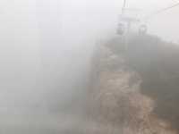
Original TextYesterday, the ropeway at 9:30 in the morning was basically not lined up, only took the North ropeway, the scenery was really good, it was worth sitting.
Posted: May 5, 20240- 5/5Outstanding
Verified Booking
Original TextIt is really convenient to buy a joint ticket, and there are many discounts. It is recommended to consider the family and children who travel! !
Posted: Jul 29, 20230 - 1
- 2
- 3
- 4
- 41
Recommended Attractions at Popular Destinations
Bangkok attraction near me | Tokyo attraction near me | Manila attraction near me | Hong Kong attraction near me | Taipei attraction near me | Seoul attraction near me | Los Angeles attraction near me | New York attraction near me | Shanghai attraction near me | Kuala Lumpur attraction near me | Shenzhen attraction near me | Osaka attraction near me | Singapore attraction near me | London attraction near me | Guangzhou attraction near me | San Francisco attraction near me | Beijing attraction near me | Macau attraction near me | Bali attraction near me | Paris attraction near me | Ho Chi Minh City attraction near me | Orlando attraction near me | Jakarta attraction near me | Chicago attraction near me | Phuket attraction near me | Toronto attraction near me | Fukuoka attraction near me | Istanbul attraction near me | Dallas attraction near me | Chiang Mai attraction near me
Popular Attractions
Degener OPEL Museum (DOM) - Vogelsang IP (NS-Ordensburg) | Chinnar Check Post | Sunway Lagoon Theme Park | Bharat Sevashram Sangh - Kedarnath | Statue of Liberty | Dujiangyan Irrigation System | Hungarian Parliament Building | Hong Kong Disneyland | Montréal Underground City | Musee d'Orsay | Universal Orlando Resort | Insa-dong | Wuzhen Water Town | Prasat Ta Tnur | Do Spirits Return | Ramayana Water Park | Kakolat Waterfalls | Anfu Road | Lisbon Central Mosque | Boyalıca Kasabası camii | Park | Ravine Park | Motomiya Nichome Daini Park | Vinayagar Temple | Kriegerdenkmal SV Niederschopfheim | Sungai Lamandau full | Akebono Golf Club | Shiv Mandir | Narsingh Temple | Shanghai Disney Resort
Payment Methods
Our Partners
Copyright © 2024 Trip.com Travel Singapore Pte. Ltd. All rights reserved
Site Operator: Trip.com Travel Singapore Pte. Ltd.
Site Operator: Trip.com Travel Singapore Pte. Ltd.