OverviewBookNearbyReviewsWin PrizesDetailsRecommended
Share to
Koko Crater Railway Trailhead
3.1
9 Reviews
 based on 2638 reviews
Open Opens at 6:30-23:00
Recommended sightseeing time:1-3 hour
Address:
7604 Koko Head Park Rd #7602, Honolulu, HI 96825, United StatesMap
Phone(808) 522-7060
What travelers say:
Cape, Oahu, Hawaii, USAThe cape (whose name means "blood" or "red earth") is pocked by numerous tuff craters, relics of the island's last volcanic activity.These include Koko Head Crater, at an elevation of 642 feet (196 metres) near Kawaihoa Point.
More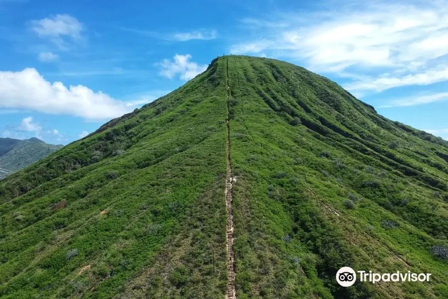
See all 2 photos
Saved by 3
Koko Crater Railway Trailhead Highlights: Must-See Features and Attractions
Some information may have been translated by Google Translate
The Cape Coco Trail is located in Hawaii, USA and is a very famous hiking route. During World War II, it was built to transport supplies for military personnel on the top of the mountain, and more than 1,000 sleepers were used. Now, with its beautiful scenery and pleasant climate, it is a paradise for hikers.
Recommendations Near Koko Crater Railway Trailhead
Koko Crater Railway Trailhead Reviews: Insider Insights and Visitor Experiences
Some reviews may have been translated by Google TranslateWrite a Review
 (9 Reviews)Trip.com
 (2,638 Reviews)TripAdvisor
/5
Outstanding ReviewsAll (9)
Latest
With Photos (7)
Positive Reviews (9)
- 1
- 2
Additional Information
You Might Also Like
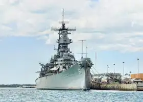
Battleship Missouri Memorial
6.0
4.5/5146 Reviews
From €31.09
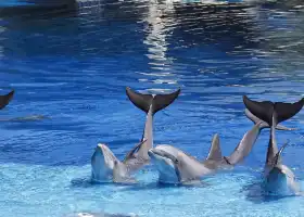
Sea Life Park Hawaii
4.9
4.6/547 Reviews
From €43.83
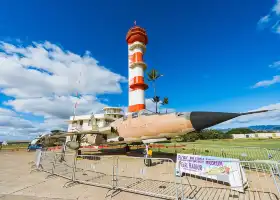
Pearl Harbor Aviation Museum
4.2
4.5/570 Reviews
From €24.02

Pearl Harbor
6.8
4.7/5478 Reviews
Free
Nearby Attractions
Waikīkī Beach | Pearl Harbor | Diamond Head | Kualoa Ranch | O‘ahu | Hanauma Bay | Battleship Missouri Memorial | Iolani Palace | Atlantis Submarines Waikiki | Waikiki Trolley | Byodo-In Temple | Lanikai Beach | Sea Life Park Hawaii | Ala Moana Regional Park | Manoa Falls | Honolulu Zoo | Nuʻuanu Pali Lookout | Pearl Harbor National Memorial | Pearl Harbor Aviation Museum | King Kamehameha Statue | Mokoliʻi | Halona Blow Hole | Oahu Island Diving Experience | Kapiʻolani Regional Park | Pearl Harbor Historic Sites Visitor Center | Kāhala Beach | Dolphins and You: Watch Dolphins in Oahu | Aloha Stadium | Kailua Beach Park | Sandy Beach
Popular Types of Attractions in Honolulu
Outdoor Sports | Water Sports | Hiking | Golf Courses | Parks | City Parks | Botanical Gardens | Zoos | Nature | Beaches | Nature Reserves | Seashores | Sightseeing Tours | Water Activities | Other Sightseeing Tours | Boat Tours | Lifestyle | Spas | Libraries | Entertainment Centers | Exhibition Centers | Museums | Art Museums | Art Galleries | Religious Sites | Churches and Cathedrals | Temples | Other Places of Worship | Architecture & Landmarks | Gardens
Popular Restaurants in Honolulu
Michel's at the Colony Surf | Highway Inn Kaka'ako | Sweet E's Café | Café Kaila | Hula Grill Waikiki | Rainbow Drive-In | Hoku's | The Boardroom | Piko Kitchen + Bar | The Cutlery - Kaimuki's Neighborhood Steakhouse & Barbershop | An Di Dzo | Wolfgang's Steakhouse Waikiki | Yama's Fish Market | Khan Skewer Restaurant | PESCA Waikiki Beach | TEX 808 BBQ + Brews Waikiki | Waikiki Leia | Young's Fish Market | Morton's The Steakhouse | Hy's Steak House | Arancino at The Kahala | Ginza Bairin Tonkatsu & Yoshoku Bistro | Hokkaido Ramen Santouka | Haili's Hawaiian Foods | Bills Hawaii | The Tchin Tchin! Bar | Cheeseburger In Paradise | Azure | The Cheesecake Factory | Orchids
Recommended Attractions at Popular Destinations
Bangkok attraction near me | Manila attraction near me | Tokyo attraction near me | Taipei attraction near me | Hong Kong attraction near me | Seoul attraction near me | Los Angeles attraction near me | Kuala Lumpur attraction near me | Shanghai attraction near me | New York attraction near me | Shenzhen attraction near me | Osaka attraction near me | London attraction near me | Singapore attraction near me | Guangzhou attraction near me | San Francisco attraction near me | Beijing attraction near me | Macau attraction near me | Bali attraction near me | Paris attraction near me | Jakarta attraction near me | Ho Chi Minh City attraction near me | Orlando attraction near me | Phuket attraction near me | Toronto attraction near me | Chicago attraction near me | Cebu attraction near me | Seattle attraction near me | Istanbul attraction near me | Fukuoka attraction near me
Popular Ranked Lists
Top 17 Local Restaurants in San Francisco | Popular Luxury Hotels Near Lombard | Popular Family-friendly Attractions Near Wangmo | Popular Family-friendly Attractions Near Xiaochang | Top 4 Premium Hotels in Luzhou | Top 3 Luxury Hotels in Khao Yai | Popular Family-friendly Attractions Near Yanchuan | Popular Family-friendly Attractions Near Fusong | Popular Family-friendly Attractions Near Qiu County | Popular Family-friendly Attractions Near Wannian | Top 4 Premium Hotels in Qufu | Popular Family-friendly Attractions Near Fuchuan | Popular Luxury Hotels in Capital Region | Popular Family-friendly Attractions Near Laohekou | Top 5 Premium Hotels in Baotou | Popular Premium Hotels in Huludao | Popular Family-friendly Attractions Near Quwo | Popular Luxury Hotels Near Volusia County | Top 16 Local Restaurants in Edinburgh | Popular Family-friendly Attractions Near Manzhouli | Popular Family-friendly Attractions Near Sui County | Popular Luxury Hotels Near Bargara | Popular Family-friendly Attractions Near Aohan Banner | Top 10 Local Restaurants in Nairobi | Popular Family-friendly Attractions Near Shilou | Top 19 Local Restaurants in Shijiazhuang | Top 7 Premium Hotels in Beihai | Top 10 Local Restaurants in Brisbane | Top 20 Local Restaurants in Zhuhai
Popular Trip Moments
Two night stay at Hyatt Regency Waikiki | Hyatt Centric Waikiki | Lunch at a Seaside Hotel in Hawaii | Discover the Joy of Choosing Classic Hawaiian Souvenirs at Honolulu Cookie Company. | 🌴✨ Waikiki Wonders: Top Hotel Picks for Hawaiian Getaways 🏖️🍹 | Breathtaking Views! Comfortable Amenities! Stay at the Marriott Ko Olina Beach Club Penthouse. | Who knows about the Diamond Head in Hawaii! It's really photogenic | Four Seasons Resort Oahu at Ko Olina | 🌴 Summer Fun at Halekulani Waikiki | 🌴 Stay at Outrigger Reef Waikiki | 🌴 Sheraton Waikiki Beach | Hilton Waikiki Beach | Ho'omaluhia Botanical Garden. | Hyatt Centric Waikiki Beach | 🌺 Honolulu's Top Hotel Havens: Luxe Stays & Views 🌴 | The sunset is coming, it's really too beautiful!!! | 🌺 Honolulu's Hotel Gems: Luxe Stays & Tropical Escapes 🌴 | Hawaii, you truly deserve the title of top-tier among islands! | Hawaii Honolulu/Oahu Travel Guide | Beautiful Airport 🌺 | Exploring Waikiki 🌺 | Shopping in Hawaii 🌺 | Lovely hotel in Waikiki | Waimea Bay Beach Park | Summer in Hawaii - Breathtakingly beautiful rainbow | Modern museum with beautiful artifacts | Aloha, Hanauma Bay, O'ahu! | Feels like the movie | Aloha!
Popular Travel Types
More Things To Do in Honolulu
Chief's Luau Admission | Go City: Oahu All-Inclusive Pass (Discover over 50 top attractions | Moana Splash Luau, Polynesian Cultural Center & more) | Hawaii: Wet 'n' Wild Entry Ticket + Transportation from Waikiki | Keauhou Manta Ray Night Snorkel | All Day Circle Island Tour with Snorkeling | Afternoon Waikiki Glass Bottom Boat Cruise | One-day tour to Pearl Harbor from Honolulu, Hawaii, USA [Arizona Memorial and Honolulu City Highlights Tour 29486] | Bishop Museum General Admission Ticket | Honolulu Airport Waikiki Shuttle Service | Queens Waikiki Luau | One-day trip to Kualoa Ranch in Honolulu, Hawaii, USA [Classic Experience Package Movie Scene + Tropical Orchard Tasting + Jungle Adventure + Light Meal + Transfer] | Pearl Harbor Aviation Museum: Entry Ticket | Dolphin and You one-day trip to Honolulu, Hawaii, USA [Dolphin and You ecological zone snorkeling tour with private car transfer] | One-day trip to Hawaii Water Park in the United States [Various ticket packages + water park + bus and hotel pick-up] | E-Bike Rental In Waikiki | Premium Kona Coast Morning Snorkel | Big Island Snorkel Cruise from Waikoloa | Oahu Grand Circle Island Experience Departing from Kauai | The East Waikiki Walking Tour | Explore O’ahu island with a friendly local in a small group | Private Transfer: Honolulu to Honolulu Airport HNL in Luxury SUV | Sights & Bites Island Tour | Majestic Circle Island Eco Tour from Waikiki | Large Group Private Charters : 5 in 1 Deluxe | Private Tour from Hilo to Hawaii Volcanoes Natl Park Mercedes Van | Honolulu, USA - Waikiki Yacht Cruise - 4 hours charter including snorkeling equipment | Kailua Stand Up Paddle Boarding Lesson | Pearl Harbor Deluxe Uncovered Tour with Lunch | Mānoa Falls Trail Hiking Shuttle
Payment Methods
Our Partners
Copyright © 2024 Trip.com Travel Singapore Pte. Ltd. All rights reserved
Site Operator: Trip.com Travel Singapore Pte. Ltd.
Site Operator: Trip.com Travel Singapore Pte. Ltd.
Cape, Oahu, Hawaii, USAThe cape (whose name means "blood" or "red earth") is pocked by numerous tuff craters, relics of the island's last volcanic activity.These include Koko Head Crater, at an elevation of 642 feet (196 metres) near Kawaihoa Point.
Cape Koko (Koko Head Crater) is one of the popular hiking spots in Honolulu, Hawaii, and a famous dead volcano. It features more than 1,000 rail steps, with a slope that is not small and challenging for physical strength. The track is no longer running on it, and there were former World War II trains carrying military personnel and supplies to the top of the mountain. It is no joke to walk here to be safe. The view from the top of the mountain is good, not only can you see the outer edge of the crater bowl, but also overlook the nearby bay and town.
The Cape Koko hiking trail is suitable for tourists of all ages to hike the mountain. The trail itself is not difficult to walk, but the weather in Oahu is hot, so pay attention to sun protection and replenish water in time. Some sections are rugged and very steep, so pay attention to safety.
It is a very popular hiking route! Koko Head is located in the eastern part of Honolulu, Hawaii, next to the famous snorkeling resort Dinosaur Bay Nature Reserve (Hanauma Bay Nature Preserve), which are two dead craters, but the former is higher than the latter, and the latter has been covered by seawater to form a bay. In the Cape Koko Regional Park (Koko Head District Park), there is an abandoned railway track leading to the top of Koko Head, which was built during World War II to transport supplies for military personnel and facilities on the top of the mountain, with a total of 1,048 sleepers. But it has become a popular destination for locals and tourists to hike and climb, some people can reach the top of the mountain in 20 to 30 minutes, and some will take more than an hour or even halfway to give up. The reason is that this railway is straight up and down, mainly divided into two parts, the first half is relatively flat, many people can accept, the second half of the slope makes many people afraid, and there is my momentum of Tianchao Huashan. The first half and the second half of the combination, there are dozens of meters of air rail, below is three or four meters deep ditch, many people dare not pass from the top, can only detour the path next to it. Once at the top, there are many military installations such as abandoned bunker watchtowers, where you can enjoy the 360-degree view of eastern Honolulu. Macapwu Point (Makapuu Point), Dinosaur Bay Nature Reserve (Hanauma Bay Nature Preserve), Sandy Beach, Hawaii Kai (Hawaii Kai ) and other world-class scenery are in front of you, and you can also see the Diamond Mountain (Diamond Head) and Waikiki in the distance. You need to pay attention to safety while enjoying the beautiful scenery on the top of the mountain. Try to stay away from the cliffs, sometimes blowing a lot of wind. The first time I came here, I should not be greedy. When I am gradual, too many strong men are tired on this railway. Up and down the mountain, you need to pay attention to the pillows on the railway to avoid being mixed. In addition to this abandoned railway, There are also a few wild roads and mountains, but it is not recommended that you try. Safety first, do your best! by Youli Zhao
Excellent hike to the top of the crater. Almost as beautiful as Diamond Hill. The path looks longer than 1.5 miles. It looks more like 3 miles. Anyway, it's worth it. If you go in the afternoon, be sure to bring water when it gets hot and there is no shadow or little. Get your phone and camera ready.