
Things to do in Tashkurgan
Explore top experiences
Top 10 attractions in Tashkurgan


Pamir Plateau
Pamirs Plateau is located in West China, extending across Tajikistan, China and Afghanistan. Consisting of East and West parts, Pamirs Plateau has a number of high mountains. East Pamirs is broad and level, formed by two mountain ranges oriented from northwest to southeast and a group of rivers, valleys, lakes and basins. West Pamirs is formed by multiple mountains and valleys running in parallel from northeast to southwest. West Pamirs is distinguished by its varied terrain, with high mountains and deep valleys.Tashkurgan · 3.4 km from downtown

Pamir Tourism Area
The Pamir Tourism Area is located in the western border of Xinjiang, China, and the eastern part of the Pamir Plateau. It is the only way for the ancient Silk Road's southern and central routes to West Asia, South Asia and Europe. In the Tang Dynasty, the Congling Shouzhuo City was set up here, and in the Yuan Dynasty, a post station was set up here. The Pamir Tourism Area is rich in tourism resources and beautiful scenery. The world-famous ancient stone city ruins, the unique Tajik customs and culture, the fascinating national wetland park Jincaotan, the long-standing Silk Road culture, the exotic and precious plateau creatures, and the harmonious coexistence of man and nature. It integrates the magnificent plateau natural scenery, profound historical culture and rich folk customs, and has become a civilized tourist destination. The overall planning area of the Pamir Tourism Area is 3.1 square kilometers, consisting of five major areas: the tourist service center, the ancient stone city ruins, the intangible cultural heritage display area, the wetland park Jincaotan, and the Caiyun People Folk Village. In 2014, it was awarded the title of "International Plateau Customs Tourism Destination" and "China Red Tourism Border Culture Experience Site" by the National Tourism Administration. In 2019, the national AAAAA-level tourist area was successfully established. With the support of the Ministry of Culture and Tourism of the People's Republic of China, the Department of Culture and Tourism of the Autonomous Region, and the leaders of Shenzhen's aid to Xinjiang, the popularity and reputation of the Pamir Tourist Area have continued to increase, and the number of tourists received by the Attraction has continued to rise year by year. Taxkorgan County will use the strength and wisdom of the entire county to try its best to build the Pamir Tourist Attraction into an ecological city, cultural place, and happy post station on the Silk Road, so that the place where civilizations meet can regain its splendor.Tashkurgan · 1.3 km from downtown

Panlong Ancient Road
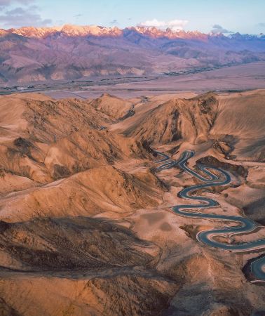
Panlong Ancient Road is a mountain road on the Pamir Plateau that has become popular in recent years, also known as the Wacha Highway, spanning a total length of approx. 36 km. It was originally built to facilitate travel for local farmers and herdsmen on the plateau: the mountain is made of loose sandy rock, making it impossible to build tunnels or bridges, so the road had to wind up along the mountain ridges following the terrain, climbing from an altitude of approx. 3,000 m to over 4,000 m. With over 600 S-bends layered on top of each other, it looks like a black dragon coiled among the mountains when viewed from the air, and is known by locals as the "Sky Road of the Plateau." The entire road is divided into two sections: Big Panlong and Small Panlong. The first section, Big Panlong, features large, sparse bends, with parking areas and viewing platforms along the way, perfect for stopping to overlook the entire mountain road. The subsequent Small Panlong section has dense bends, with a series of nearly 180-degree hairpin turns arranged neatly, offering a thrilling visual and driving experience.Tashkurgan · 22.7 km from downtown

Bandir Blue Lake
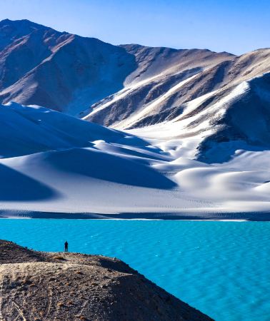
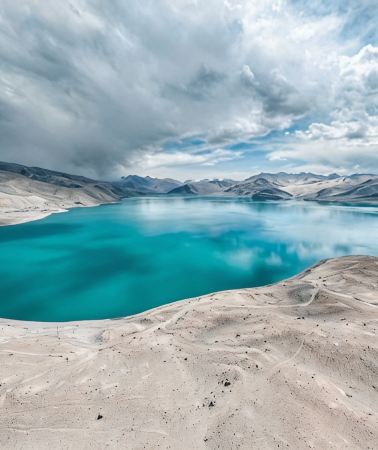
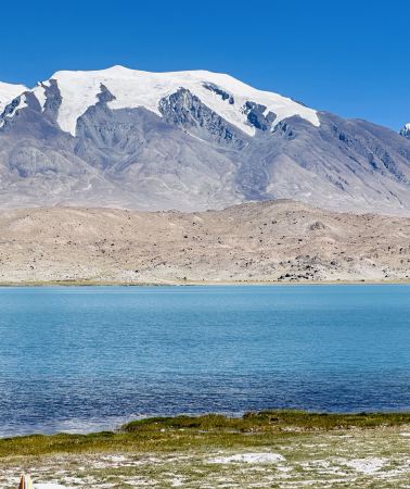
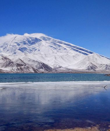
Bandir Blue Lake is not a natural lake, but a highland reservoir formed by the Xiabandi Water Control Project. The lake water comes from glacial meltwater and has a high mineral content, appearing in shades of clear light blue, peacock blue, and even deep, mysterious blue under the sunlight. The lake area is surrounded by grayish-white cliffs and snow-capped mountains, with the stark rock walls setting off a pool of blue water, exuding the tranquility of a hidden highland realm. Influenced by factors such as light, weather, water level, and the surrounding mountain environment, the lake surface presents different shades of blue and blue-green, which are particularly striking in clear weather. There are viewing platforms along the lakeside road, and open areas along the roadside are also suitable for parking and taking photos at your leisure.Tashkurgan · 19.3 km from downtown

Karakoram Highway
Karakoram Highway, also known as the Karakoram Highway, starts in Kashgar, Xinjiang, crossing the Pamir Plateau, and leads to northern Pakistan after crossing the border. It spans over 1,000 km in total, with over 400 km within China. Built in the last century through cooperation between China and Pakistan, the highway traverses the Hindu Kush and the western end of the Himalayas. Known for its challenging engineering, it is now an important international route and a classic route favored by self-drive and cycling enthusiasts. The section within China winds and climbs along the national highway. After entering Taxkorgan Tajik Autonomous County, the altitude rises to over 3,000 m. Continuing south, you arrive at, where the China-Pakistan border gate and boundary marker stand at an altitude of nearly 4,700 m.Tashkurgan · 1.6 km from downtown

Stone City Site
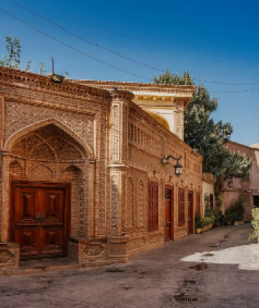
Kashgar Ancient Stone City is located northeast of the county seat of Tashkurgan County in Kashgar Prefecture. It was once the royal city of the Puli Kingdom among the "Thirty-six Kingdoms of the Western Regions" and an important stop on the ancient Silk Road. The ancient stone city of Kashgar has existed since the Jupantuo period (around the 1st century AD) and is a precious historical relic in Xinjiang. Today, only ruins and ruins remain, and visitors can only see the ruined ruins. Additionally, the lonely ancient fortress built on the hill is also perfect for photography, allowing you to avoid images of the desolate and tragic castle. Kashgar's ancient stone city is built on a hill northeast of the county seat, on a relatively high elevation that can be photographed from a distance. If you want to climb the castle, you need to pay an entrance fee. The ancient city is not large, about 300-400 meters long and wide, and can be toured in around an hour. Inside the ancient city, you can see the ruins of former city walls and houses, but they are now in ruins, so you can only imagine the prosperity of the past by looking at the silent earthen walls. Additionally, Jincaotan next to Kashgar Ancient Stone City is a great spot for viewing and photographing Kashgar Ancient Stone City. Wooden boardwalks have been built here for easy photography. At sunset, the ancient city, bathed in yellow, looks especially tragic and grand—perfect for photography.Tashkurgan · 1 km from downtown

Eye of Pamir
Eye of Pamir is a natural geological wonder in the heart of the Pamir Plateau, located along the Tasha Ancient Path on a plateau at an altitude of nearly 4,000 m. It is not a lake, but an entire mountainside made of colorful sandstone: the rock layers are stacked in tiers, with greenish hues on both sides and vibrant colors in the center. Viewed from the road, it looks just like a giant open eye gazing at passing vehicles, and is called the "pupil on the Kunlun Mountains ridge" by many photography enthusiasts. On the way back to Tashkurgan from the Panlong Ancient Road via Bandir Blue Lake, you will almost certainly encounter it. There is no need to look for it specifically, as you will see it as soon as you look up.Tashkurgan · 12.9 km from downtown

Pamir Tourism Area-Wakhan Corridor
Pamir Tourism Area-Wakhan Corridor is the entrance to the ancient Wakhan Corridor on the Chinese side. It starts in the west from the Panj River, the upper reaches of the Amu Darya, and its tributary, the Pamir River, and connects to Tashkurgan in the east. It stretches for hundreds of km from east to west, yet its width is mostly only a few km, with an average altitude of over 4,000m. It borders Tajikistan to the north, Pakistan to the south, and leads to Afghanistan in the west, situated at the intersection of four countries. It is a key section of the ancient Silk Road crossing the Pamir, and was once an important passage for exchanges between Chinese civilization and Indian civilization.Tashkurgan · 63.5 km from downtown

Khunjerab Pass
Khunjerab Pass is located within Taxkorgan Tajik Autonomous County, at an altitude of over 5,000 m, and is one of the highest altitude ports in the world. Khunjerab Pass was an important pass on the famous ancient Silk Road over 1,000 years ago. It is the land border crossing between China and Pakistan, and an important gateway to South Asia and even Europe. The scenery here is magnificent, but the environment is harsh, and it is known as the "Valley of Death." When visiting Khunjerab Pass, tourists usually take photos at the China-Pakistan Boundary Marker No. 7. Most of the residents living around the Khunjerab Pass are Tajiks, and they are known as the "people of the sky." EnteringKhunjerabfeels like arriving in a "fairyland on earth." The beautiful Tajik costumes, hospitable Tajik etiquette, and delicious Tajik cuisine all make one feel the simplicity, kindness, and friendliness of the Tajik people.Tashkurgan · 717m from downtown

Viewing Platform of Taherman Wetland Park
Viewing Platform of Taherman Wetland Parkis located along the China-Pakistan Highway. Standing on the viewing platform to view the wetland is spectacular and breathtaking.Tashkurgan · 17 km from downtown
Experiences you can't miss in Tashkurgan
Featured Day tours in Tashkurgan
View all Day tours
5.0/5
· 4 reviews· 89 bookedFree cancellation
Instant confirmation
Save US$0.56
FromUS$55.41US$55.97
5.0/5
· 1 reviewFree cancellation
Book now for tomorrow
Save US$0.74
FromUS$73.54US$74.28
4.0/5
· 1 review· 31 bookedFree cancellation
Instant confirmation
Save US$0.56
FromUS$55.41US$55.97
Free cancellation
Instant confirmation
FromUS$72.59
Featured Travel photography in Tashkurgan
View all Travel photography![Kashgar area travel photography[Wedding photo micro-movie aerial photography/wedding follow-up photography/makeup and clothing/charter tour guide customization]](https://ak-d.tripcdn.com/images/0354g12000nzra4sfE579_C_568_320.jpg?_fr=wc)
FromUS$99.49
![Kashgar area travel photography[Driver and guide + travel photography + wedding photos, aerial photography, micro-film + makeup and clothing + itinerary customization]](https://ak-d.tripcdn.com/images/0353c12000iw7u4d1AAA3_C_568_320.jpg?_fr=wc)
FromUS$16.59
![Tashkurgan Trip Moments[Photographer Services: Following Shots, Aerial Photography, Scheduled Shoots, Candid Photography, Street Photography, Portraits, Wedding Photography, Micro Films/Multilingual Translation]](https://ak-d.tripcdn.com/images/0356l12000mf7a7h9CAA7_C_568_320.jpg?_fr=wc)
![Akto Trip Moments[Travel Photography/Wedding & Commercial Photography/Micro Films & Promotional Videos/Aerial Photography/Translation Services]](https://ak-d.tripcdn.com/images/0352f12000msgrjx807D9_C_568_320.jpg?_fr=wc)
Instant confirmation
Book now for today
FromUS$248.73
Free things to do in Tashkurgan
Pamir Plateau
Tashkurgan · 3.4 km from downtownPanlong Ancient Road
Tashkurgan · 22.7 km from downtownBandir Blue Lake
Tashkurgan · 19.3 km from downtownKarakoram Highway
Tashkurgan · 1.6 km from downtownPamir Tourism Area-Wakhan Corridor
Tashkurgan · 63.5 km from downtownKhunjerab Pass
Tashkurgan · 717m from downtown
Taheman Wetland Park
Tashkurgan · 17 km from downtownViewing Platform of Taherman Wetland Park
Tashkurgan · 17 km from downtown
Waqia Township
Tashkurgan · 38.7 km from downtown
Ancient City of Kashi
China · Kashgar City
More ways to travel from Tashkurgan
Private Tours in Tashkurgan
View More Private Tours in Tashkurgan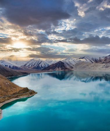




Group Tours in Tashkurgan
View More Group Tours in Tashkurgan
What travellers say about Tashkurgan

印象西南October 5, 2026
5.0
Arriving at the Pamir Plateau, one truly witnesses the magnificent grandeur of western China's landscape. Starting from Kashgar and traveling along the Karakoram Highway, snow-capped mountains, lakes, and deserts unfold before your eyes in breathtaking scenery—a must-do route in southern Xinjiang.
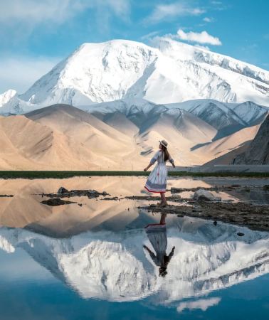
Along the way, you'll stop at White Sand Lake and Karakol Lake, facing Muztagh Ata Peak directly. The pristine snow-capped mountains reflected in the azure lakes create stunning photographs. The winding Panlong Ancient Road offers a unique and immersive experience. Along the way, you can also experience the unique culture and customs of the Tajik people—their simple and honest nature, the vast and tranquil plateau, far removed from the hustle and bustle of the city, a truly healing experience.
This is a border region, so a border permit must be obtained in advance; without it, you will not be able to pass. The overall altitude is very high, mostly above 3000 meters, making altitude sickness a common concern. Slow down your movements and bring oxygen cylinders and glucose. The temperature difference between day and night is significant; even in summer, a thick coat and windproof jacket are essential. The ultraviolet radiation is extremely strong, so sun protection and sunglasses are a must. The scenic areas are far apart and scattered, so driving or hiring a car is more suitable. Cell phone signal is weak in some sections, so downloading offline maps is recommended. The weather on the plateau is unpredictable; one moment it's sunny and clear, and the next it can be windy and snowy. There aren't many commercial facilities, so conditions are relatively basic; those seeking comfort and relaxation should expect that.
Seeing the Pamir Plateau in person makes all the travel fatigue worthwhile. For those who love natural scenery, the Pamir Plateau is definitely worth a visit.
Pamir Plateau

110***68October 5, 2026
5.0
The name of this attraction is a bit confusing; it's actually located in Tashkurgan County, specifically at the Stone City and Golden Grassland. The entire attraction can be completed in about two hours.
This is an easily overlooked spot, but it's highly recommended. Absolutely recommended!
It's right in the county town. A fantastic location for viewing the reflection of Muztagh Ata Peak. We arrived in the morning.
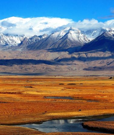
The Golden Grassland offers excellent views of the snow-capped mountains or the reflection of Stone City.
Drones are prohibited from flying nearby due to the presence of an airport.
Pamir Tourism Area

独行万里🐶October 4, 2026
5.0
Panlong Ancient Road, located in Wacha Township, Tashkurgan County, Kashgar Prefecture, is a renowned scenic highway on the Pamir Plateau. The 36-kilometer-long road winds its way through the Kunlun Mountains, featuring over 600 S-shaped and U-shaped bends, resembling a giant dragon lying across the landscape, hence its name.
The road's altitude rises from 3000 meters to 4216 meters, a drop of over 1200 meters. Built along the contours of the mountains, the road is tightly wound and intricate, offering breathtaking views at every turn. Looking around, vast valleys, rolling hills, and distant snow-capped peaks create a magnificent panorama of the plateau.
Originally a rural path, the road was paved with asphalt in 2019, greatly facilitating travel for local villagers. The slogan at the exit, "Having traversed all the winding roads today, from now on, life will be smooth sailing," imbues the road with a beautiful meaning, making it a unique and memorable destination for countless self-driving travelers.
Panlong Ancient Road

yccuiOctober 2, 2025
5.0
After leaving Panlong Ancient Road, we headed back to Kashgar in the afternoon. We visited several scenic spots along the Wuhong Line and National Highway 314, including: Bandir Blue Lake, known as the "blue eyes" of the Pamir Plateau, Taheman Wetland (Figures 6 and 7), and the Red Mountain Canyon of Aoyitak Glacier Park.
Bandir Blue Lake

正黄小菊May 3, 2025
5.0
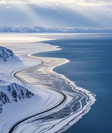
The China-Pakistan Friendship Highway from Kashgar to Tashkurgan County and then to Khunjerab is very easy to drive and the scenery is so beautiful. Watch my video, there are two sections on the China-Pakistan Friendship Highway. If you don't have high sickness when driving, just go up all the way. I went there in March, when the winter snow just started to melt, it was as if people and cars were driving in an oil painting... Come and experience it!
Karakoram Highway

酷到爆炸中的大白菜August 31, 2025
4.0
For travelers to southern Xinjiang, Tashi County is a good stopover, especially for group tours, which typically require a two-night stay. However, most tour groups don't include a visit to Stone City in Tashi County. However, we recommend exploring Stone City after arriving in Tashi County, especially after dinner. Stone City is steeped in history and boasts stunning scenery. The wetlands beneath the mountains are unique against the vibrant yellow of southern Xinjiang. Evening performances include folk songs and dances, as well as folklore exhibitions. Stone City is particularly easy to explore, and those experiencing altitude sickness can take a leisurely stroll. There's a snack street just outside Stone City.
Stone City Site
M25***52May 7, 2026
4.0
The description of this attraction is incorrect. The picture shows the "Devil's Eye" of Mount Muji, which is easily misleading to tourists. In reality, this attraction is a huge, eye-shaped mountain that we passed on the way back from Banjier Blue Lake along the Panlong Ancient Trail; it's quite impressive.
Eye of Pamir

i love tripSeptember 19, 2025
5.0
Experience Tajik Customs: The surrounding area is primarily inhabited by the Tajik people, known as the "Heavenly People." They are hospitable and have unique cultural practices, such as sheep-grabbing, eagle flute, and eagle dance.
Major Attractions: The China-Pakistan Highway from Kashgar to Khunjerab is a magnificent scenic drive, passing through:
Aoyitake Forest Park: A combination of grandeur, unique beauty, elegance, seclusion, and peril.
Karakul Lake: A high mountain glacial moraine lake, its waters frame the towering Muztagh Ata, creating a captivating scene.
Muztagh Ata: Known as the "Father of Icebergs," it is a destination for mountaineering enthusiasts.
Stone City Ruins: A renowned ancient city ruin on the ancient Silk Road, steeped in history.
Princess Castle: A military engineering site related to traffic safety along the ancient Silk Road, steeped in legends.
Travel Permits: Chinese citizens traveling to Tashkurgan County and the Khunjerab Pass area must obtain a border pass in advance in Kashgar.
Best Time: Although the border crossing is now open year-round, the plateau region's summer (May-October) offers relatively mild weather and beautiful scenery, making it a more suitable time for travel.
Transportation: You can charter a car or take a shuttle bus from Kashgar to Tashkurgan County, then rent a car to reach the border crossing. Road conditions are complex along the way, so it's recommended to hire an experienced driver.
Altitude Sickness: The border crossing is at an extremely high altitude, so be sure to take precautions against altitude sickness. Prepare in advance, avoid strenuous exercise, and allow ample time to acclimate.
Policy Verification: Border crossing policies (such as the scope of tourist access) are subject to change at any time. Be sure to check with relevant authorities for the latest information before traveling.
The Khunjerab Pass is not only a geographical peak, but also a bridge of friendship and a historic passage connecting China and Pakistan.
Khunjerab Pass

gz当地向导伊妹儿April 12, 2021
5.0
From the observation deck of Taheman Wetland Park, you can see the beautiful scenery. It is very beautiful and has a wide field of view. It is a good choice, which makes people feel relaxed and refreshed. It is very cost-effective and interesting.
Viewing Platform of Taherman Wetland Park


